
File:Satellite image of 2015 Southeast Asian haze - 20150905.jpg

預覽大小:671 × 599 像素。 其他解析度:269 × 240 像素 | 538 × 480 像素 | 860 × 768 像素 | 1,147 × 1,024 像素 | 2,293 × 2,048 像素 | 4,881 × 4,359 像素。
原始檔案 (4,881 × 4,359 像素,檔案大小:11.93 MB,MIME 類型:image/jpeg)
摘要
| 描述 |
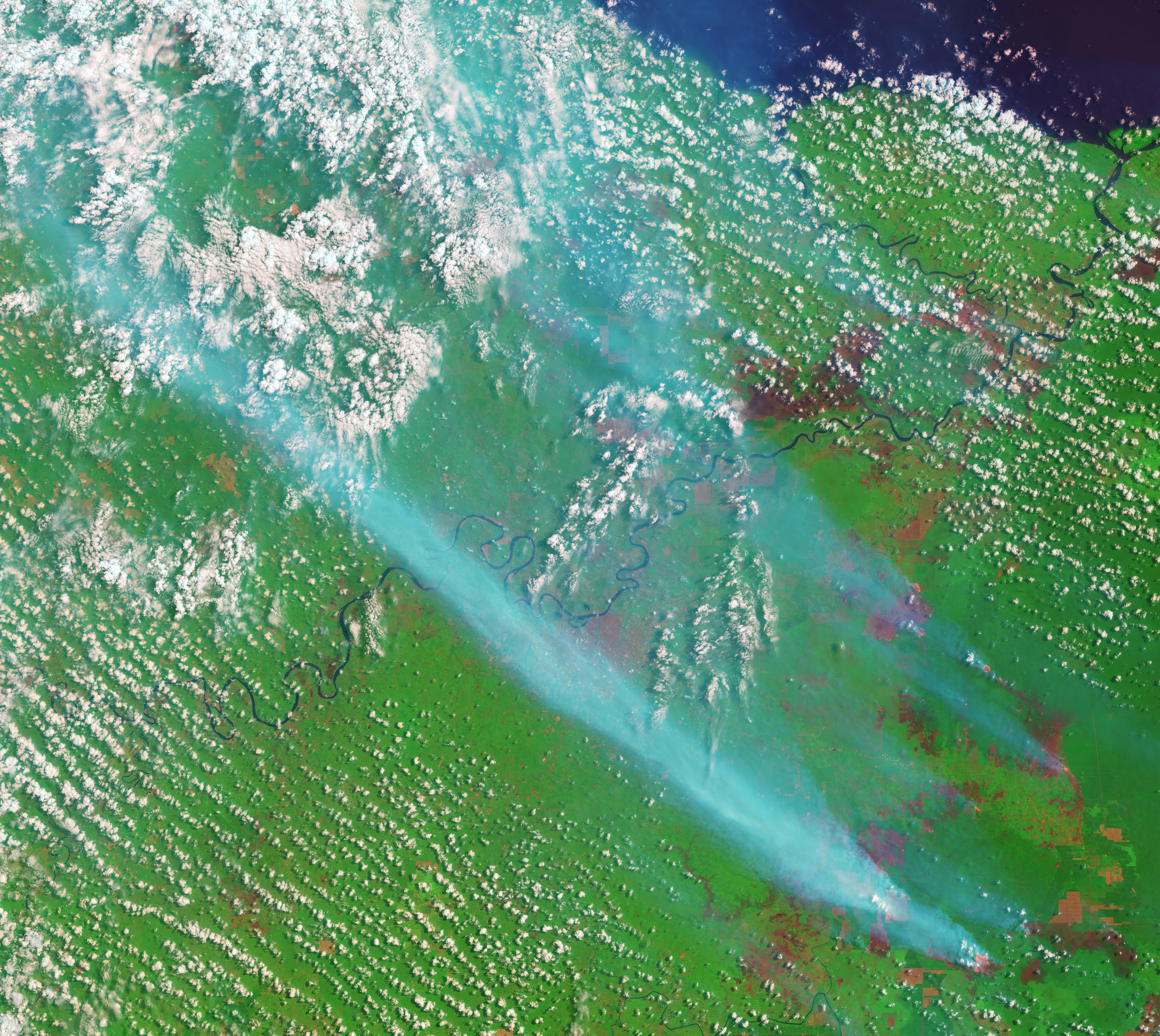
English: On September 5, 2015, the Operational Land Imager on the Landsat 8 satellite acquired this image of smoke billowing from fires in Jambi Province on the Indonesian island of Sumatra. The false-color image was made with a combination of visible (green) and infrared light so that fires and freshly burned land stand out. Fires glow orange, and newly burned land is dark red. The blue smudges running diagonally across the image are smoke. Bare soil or older burn scars are a lighter shade of red. Clouds are white. The lower image shows a broader view of the area.
Caption by Adam Voiland.The fact that the fires burned within well-defined rectangular grids suggests that these were agricultural fires intentionally set by growers. According to land-use maps published by Global Forest Watch, the fires are burning within a palm oil plantation. Palm oil production is highly profitable, and the commodity is an important export for Indonesia, the world’s largest producer. The Jakarta Post reported that heavy smoke from the fires in Sumatra has caused levels of air pollution to spike throughout the island and in parts of Malaysia. |
| 日期 | |
| 來源 | http://eoimages.gsfc.nasa.gov/images/imagerecords/86000/86596/jambi_oli_2015248_swir_lrg.jpg |
| 作者 | NASA Earth Observatory image by Joshua Stevens |
授權條款
| 本作品由NASA創作,屬於公有領域。根據NASA的版權政策:“NASA的創作除非另有聲明否則不受版權保護。”(參見:Template:PD-USGov/zh,NASA版權政策或JPL圖像使用政策) | ||
 |
警告:
|
檔案歷史
點選日期/時間以檢視該時間的檔案版本。
| 日期/時間 | 縮圖 | 尺寸 | 使用者 | 備註 | |
|---|---|---|---|---|---|
| 目前 | 2015年9月24日 (四) 12:08 | | 4,881 × 4,359(11.93 MB) | RectorRocks | {{subst:Upload marker added by en.wp UW}} {{Information |Description = {{en|On September 5, 2015, the {{w|Operational Land Imager}} on the {{w|Landsat 8}} satellite acquired this image of smoke billowing from fires in Jambi Province on the Indonesian i... |
檔案用途
下列頁面有用到此檔案: