
File:CapeCodCanalEastEndAerial.jpg

此為最大尺寸。
CapeCodCanalEastEndAerial.jpg (270 × 365 像素,檔案大小:16 KB,MIME 類型:image/jpeg)
摘要
| 描述 |
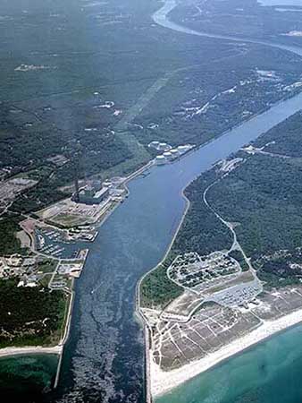
English: Aerial photo of the East End of the Cape Cod Canal and Scusset Beach State Reservation in southeastern Massachusetts, USA. |
| 來源 | http://www.nae.usace.army.mil/recreati/ccc/recreation/recreation.htm |
| 作者 | U.S. Army Corps of Engineers |
| 其他版本 | http://www.nae.usace.army.mil/Portals/74/siteimages/Recreation/CCC/Web-site-photos/010827-A-KF207-001.JPG?ver=2016-12-22-133017-940 |
| 拍攝地點 | | 位於此地的本圖片與其他圖片: OpenStreetMap |
|---|
授權條款
|
|
 |
檔案歷史
點選日期/時間以檢視該時間的檔案版本。
| 日期/時間 | 縮圖 | 尺寸 | 使用者 | 備註 | |
|---|---|---|---|---|---|
| 目前 | 2009年10月31日 (六) 15:31 | | 270 × 365(16 KB) | OldPine | {{Information |Description={{en|1=Aerial photo of the East End of the Cape Cod Canal and Scusset Beach State Reservation in southeastern Massachusetts, USA.}} |Source=http://www.nae.usace.army.mil/recreati/ccc/recreation/recreation.htm |Author=U.S. Army C |
檔案用途
下列頁面有用到此檔案:
全域檔案使用狀況
以下其他 wiki 使用了這個檔案:
- ar.wikipedia.org 的使用狀況
- en.wikipedia.org 的使用狀況
- Cape Cod Canal
- Intracoastal Waterway
- Wikipedia:Selected anniversaries
- Wikipedia:Main Page/Temp10
- Wikipedia:Main Page alternatives/(simple layout)
- Wikipedia:Selected anniversaries/July
- Wikipedia:Selected anniversaries/July 29
- Talk:July 29
- Wikipedia:Selected anniversaries/All
- User:Krik~enwiki/mp
- User:Krik~enwiki/nmp
- Wikipedia:Main Page/test
- User:Hemanshu/edmainpage
- User:The bellman
- User:Node ue/MainPageTemplate2
- User:Afterword
- User:Tom-/sandbox
- User:Sj/M2
- Portal:History
- User:Tim Robinson/Main Page (Proposal)
- Talk:Main Page/Archive 34
- User:Pufferfish101/Edit
- User:Allard
- User:MarSch/Main page
- User:MarSch/Main body
- User:Eloquence/Tour 01
- User:Lovelac7
- User:Member/Wikipedia Front Page
- Wikipedia:Wikifun/Round 9/Answers/Question 29
- User:DonWilson
- Wikipedia:Main Page alternatives/(Old PDA version)
- User:Vincent7
- User:4v4l0n42/Today
- User:RaptorX
- User:Kinhull
- Wikipedia:WikiProject Usability/Main Page/Draft
- Wikipedia:WikiProject Usability/Main Page/Draft (current templates)
- Wikipedia:WikiProject Usability/Main Page/Draft2
- Wikipedia:WikiProject Usability/Main Page/Draft2 (fullsize text)
- Wikipedia:WikiProject Usability/Main Page/Draft (Italian Inspired)
- User:Drumguy8800/Main page draft
- Wikipedia:WikiProject Usability/Main Page/Draft A
- Wikipedia:WikiProject Usability/Main Page/Draft C
- Wikipedia:WikiProject Usability/Main Page/Draft 6C
- Wikipedia:WikiProject Usability/Main Page/Draft 6D
- User:Nickg331
- Wikipedia:Main Page alternatives/(editable)
- Wikipedia:Main Page alternatives/(blue boy)
- Wikipedia:WikiProject Usability/Main Page/Draft L
檢視此檔案的更多全域使用狀況。