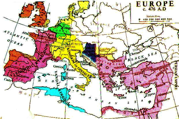
File:Central Europe 5th Century.jpg

預覽大小:800 × 561 像素。 其他解析度:320 × 224 像素 | 640 × 449 像素 | 1,088 × 763 像素。
原始檔案 (1,088 × 763 像素,檔案大小:457 KB,MIME 類型:image/jpeg)
檔案歷史
點選日期/時間以檢視該時間的檔案版本。
| 日期/時間 | 縮圖 | 尺寸 | 用戶 | 備註 | |
|---|---|---|---|---|---|
| 目前 | 2017年3月20日 (一) 13:11 |  | 1,088 × 763(457 KB) | Julieta39 | Lakes, and also North Sea shoreline before the All Saints flood, with the Flevo-Almeere lake (see [https://fr.wikipedia.org/wiki/Lac_Flevo] and [https://en.wikipedia.org/wiki/Almere_(lake)]°. |
| 2010年1月18日 (一) 00:15 |  | 1,088 × 763(568 KB) | Varoon Arya~commonswiki | Contrast tweak | |
| 2010年1月18日 (一) 00:09 |  | 1,088 × 763(561 KB) | Varoon Arya~commonswiki | More accurate map with tributary rivers; additional peoples added; colours toned down somewhat. | |
| 2010年1月17日 (日) 13:25 |  | 547 × 525(238 KB) | Varoon Arya~commonswiki | Corrected border between Syagrius and Alamannia | |
| 2010年1月17日 (日) 05:07 |  | 547 × 525(239 KB) | Varoon Arya~commonswiki | Reverted to version as of 17:14, 16 January 2010 my mistake on file type | |
| 2010年1月17日 (日) 00:48 | 沒有縮圖 | (387 KB) | Varoon Arya~commonswiki | Corrected border between the Alamanni and Syagrius | |
| 2010年1月16日 (六) 17:14 |  | 547 × 525(239 KB) | Varoon Arya~commonswiki | {{Information |Description={{en|1=Map of Central Europe ca. 480 AD.}} |Source={{own}} |Author=Varoon Arya |Date=2010-01-16 |Permission= |other_versions= }} |
檔案用途
全域檔案使用狀況
以下其他 wiki 使用了這個檔案:
- af.wikipedia.org 的使用狀況
- ang.wikipedia.org 的使用狀況
- an.wikipedia.org 的使用狀況
- ast.wikipedia.org 的使用狀況
- bg.wikipedia.org 的使用狀況
- ca.wikipedia.org 的使用狀況
- cs.wikipedia.org 的使用狀況
- en.wikipedia.org 的使用狀況
- eo.wikipedia.org 的使用狀況
- es.wikipedia.org 的使用狀況
- et.wikipedia.org 的使用狀況
- fi.wikibooks.org 的使用狀況
- fr.wikipedia.org 的使用狀況
- ga.wikipedia.org 的使用狀況
- gl.wikipedia.org 的使用狀況
- hr.wikipedia.org 的使用狀況
- hu.wikipedia.org 的使用狀況
- id.wikipedia.org 的使用狀況
- incubator.wikimedia.org 的使用狀況
- it.wikipedia.org 的使用狀況
檢視此檔案的更多全域使用狀況。


