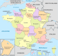
File:Switzerland, administrative divisions - de - colored.svg

此 SVG 檔案的 PNG 預覽的大小:800 × 513 像素。 其他解析度:320 × 205 像素 | 640 × 410 像素 | 1,024 × 656 像素 | 1,280 × 820 像素 | 2,560 × 1,641 像素 | 4,210 × 2,698 像素。
原始檔案 (SVG 檔案,表面大小:4,210 × 2,698 像素,檔案大小:554 KB)
檔案歷史
點選日期/時間以檢視該時間的檔案版本。
| 日期/時間 | 縮圖 | 尺寸 | 使用者 | 備註 | |
|---|---|---|---|---|---|
| 目前 | 2022年1月9日 (日) 14:15 |  | 4,210 × 2,698(554 KB) | Tschubby | {{Information |Description= |Source= |Date= |Author= |Permission= |other_versions= }} |
| 2012年4月4日 (三) 09:16 |  | 1,349 × 865(561 KB) | TUBS | == {{int:filedesc}} == {{Information |Description={{de|Karte der politischen Gliederung von XY (siehe Dateiname)}} {{en|Map of administrative divisions of XY (see filename)}} |Source={{own}}{{Adobe Illustrator}}{{Commonist}}{{AttribSVG|Thule in Greenl... |
檔案用途
下列頁面有用到此檔案:
全域檔案使用狀況
以下其他 wiki 使用了這個檔案:
- af.wikipedia.org 的使用狀況
- als.wikipedia.org 的使用狀況
- ban.wikipedia.org 的使用狀況
- cs.wikipedia.org 的使用狀況
- de.wikipedia.org 的使用狀況
- Bundesstaat (föderaler Staat)
- Schweiz
- Kanton (Schweiz)
- Gliedstaat
- Wikipedia:Kartenwerkstatt/Kartenwünsche
- Liste subnationaler Verwaltungseinheiten
- Diskussion:Liste subnationaler Verwaltungseinheiten
- Geographie der Schweiz
- Benutzer:Bergfex2011/Französisch-Schweizerische Grenze
- Grenze zwischen Deutschland und der Schweiz
- Vorlage:Imagemap Schweiz1
- Portal:Migration und Integration/Textabschnitt/CH
- Portal:Migration und Integration in der Schweiz
- de.wikivoyage.org 的使用狀況
- de.wiktionary.org 的使用狀況
- fi.wikipedia.org 的使用狀況
- ga.wikipedia.org 的使用狀況
- hu.wiktionary.org 的使用狀況
- hy.wikipedia.org 的使用狀況
- ia.wikipedia.org 的使用狀況
- lld.wikipedia.org 的使用狀況
- ln.wikipedia.org 的使用狀況
- nl.wikipedia.org 的使用狀況
- pfl.wikipedia.org 的使用狀況
- rm.wikipedia.org 的使用狀況
- ru.wikipedia.org 的使用狀況
- ru.wikiversity.org 的使用狀況
- sk.wikipedia.org 的使用狀況
- www.wikidata.org 的使用狀況


