File:Deathvalleysky nps big.jpg

預覽大小:800 × 258 像素。 其他解析度:320 × 103 像素 | 640 × 206 像素 | 1,024 × 330 像素 | 1,280 × 412 像素 | 4,000 × 1,288 像素。
原始檔案 (4,000 × 1,288 像素,檔案大小:1.19 MB,MIME 類型:image/jpeg)
檔案歷史
點選日期/時間以檢視該時間的檔案版本。
| 日期/時間 | 縮圖 | 尺寸 | 使用者 | 備註 | |
|---|---|---|---|---|---|
| 目前 | 2016年11月11日 (五) 16:00 | 4,000 × 1,288(1.19 MB) | SteinsplitterBot | Bot: Image rotated by 180° | |
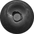
| 2007年6月24日 (日) 15:41 | 4,000 × 1,290(1.15 MB) | MagpieShooter~commonswiki | {{Information |Description=This image of en:Racetrack Playa in en:Death Valley at night was taken by Dan Duriscoe, for the en:U.S. National Park Service. http://antwrp.gsfc.nasa.gov/apod/ap070508.html |Source=Originally from [http://en.wik |
檔案用途
下列5個頁面有用到此檔案:
全域檔案使用狀況
以下其他 wiki 使用了這個檔案:
- alt.wikipedia.org 的使用狀況
- an.wikipedia.org 的使用狀況
- ar.wikipedia.org 的使用狀況
- ast.wikipedia.org 的使用狀況
- av.wikipedia.org 的使用狀況
- ba.wikipedia.org 的使用狀況
- be.wikipedia.org 的使用狀況
- bn.wikipedia.org 的使用狀況
- bxr.wikipedia.org 的使用狀況
- ca.wikipedia.org 的使用狀況
- ce.wikipedia.org 的使用狀況
- crh.wikipedia.org 的使用狀況
- cs.wikipedia.org 的使用狀況
- cv.wikipedia.org 的使用狀況
- de.wikipedia.org 的使用狀況
- el.wikipedia.org 的使用狀況
- en.wikipedia.org 的使用狀況
- Death Valley National Park
- Sky
- Racetrack Playa
- User:Kerowyn
- User:Arsonal
- User talk:Clh288
- User:Clh288
- Sailing stones
- Wikipedia:Featured pictures thumbs/07
- User:Devinma
- Wikipedia:Featured picture candidates/The Milky Way over Death Vally
- Wikipedia:Featured picture candidates/June-2007
- Wikipedia:Wikipedia Signpost/2007-06-04/Features and admins
- Wikipedia:Wikipedia Signpost/2007-06-04/SPV
- Wikipedia:Picture of the day/September 2007
- Template:POTD/2007-09-15
- User talk:Ngc1972
- Talk:Milky Way/Archive 2
- User talk:Theindigowombat
- User:Helixer
- User:Sweetness46
- User:בינה תפארת
- User:Trum5770/B1
檢視此檔案的更多全域使用狀況。


