
File:Wildfire spreads in Fort McMurray.jpg

本预览的尺寸:796 × 600像素。 其他分辨率:319 × 240像素 | 637 × 480像素 | 999 × 753像素。
原始文件 (999 × 753像素,文件大小:622 KB,MIME类型:image/jpeg)
摘要
| 描述 |
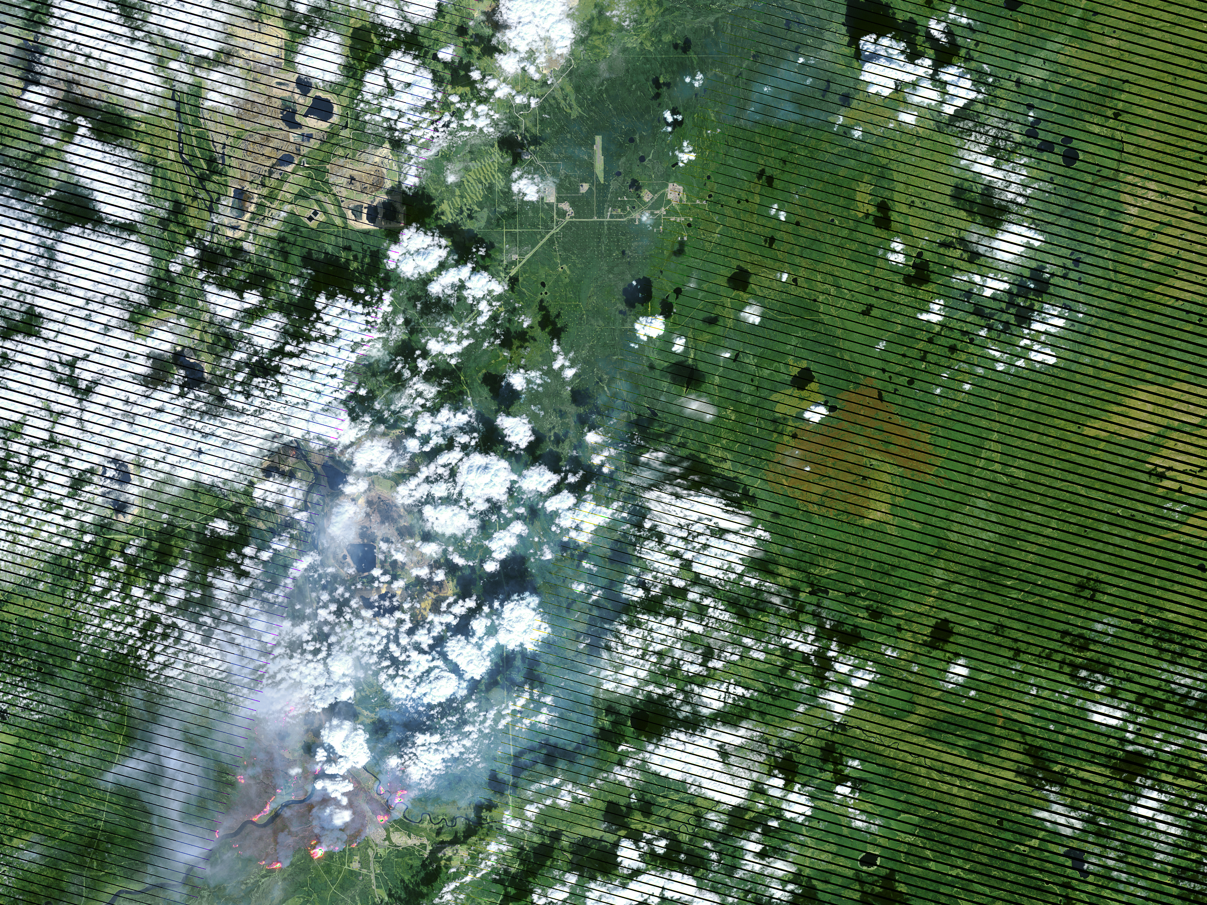
English: On May 4, 2016, the the Enhanced Thematic Mapper Plus (ETM+) on the Landsat 7 satellite acquired this false-color image of the wildfire that burned through Fort McMurray in Alberta, Canada. The image combines shortwave infrared, near infrared, and green light (bands 5-4-2). Near- and short-wave infrared help penetrate clouds and smoke to reveal the hot spots associated with active fires, which appear red. Smoke appears white and burned areas appear brown. |
| 日期 | |
| 来源 | Cropped from mcmurray_etm_2016125_swir_lrg.jpg on http://visibleearth.nasa.gov/view.php?id=87988 |
| 作者 | NASA Earth Observatory image by Joshua Stevens, using Landsat data from the U.S. Geological Survey. Caption by Kathryn Hansen |
许可协议
| 本文件完全由NASA创作,在美国属于公有领域。根据NASA的版权方针,NASA的材料除非另有声明否则不受版权保护。(参见Template:PD-USGov/zh、NASA版权方针页面或JPL图片使用方针。) | ||
 |
警告:
|
文件历史
点击某个日期/时间查看对应时刻的文件。
| 日期/时间 | 缩略图 | 大小 | 用户 | 备注 | |
|---|---|---|---|---|---|
| 当前 | 2016年5月6日 (五) 04:09 | | 999 × 753(622 KB) | Kayoty | User created page with UploadWizard |
文件用途
以下页面使用本文件:
全域文件用途
以下其他wiki使用此文件:
- ar.wikipedia.org上的用途
- de.wikipedia.org上的用途
- en.wikipedia.org上的用途
- he.wikipedia.org上的用途
- ru.wikipedia.org上的用途
- uk.wikipedia.org上的用途