
File:Map of Formosa Coal Resources 美國人所繪福爾摩沙-臺灣基隆以東煤礦分布.jpg

本预览的尺寸:800 × 503像素。 其他分辨率:320 × 201像素 | 640 × 402像素 | 861 × 541像素。
原始文件 (861 × 541像素,文件大小:89 KB,MIME类型:image/jpeg)
| 描述 |
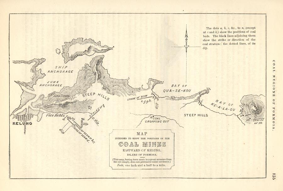
source Map of Coal Mines on Formosa Island in of Volume 2 of the Narrative of the Commodore Matthew Calbraith Perry's Expedition to Japan.
|
| 日期 | |
| 来源 | http://www.baxleystamps.com/litho/v2_formosa-map_coal-1.jpg |
| 作者 | Francis L. Hawks |
| |
本作品已被作者中文维基百科项目的User:Mababa释出到公有领域。这适用于全世界。 如果这样做不合法的话: |
文件历史
点击某个日期/时间查看对应时刻的文件。
| 日期/时间 | 缩略图 | 大小 | 用户 | 备注 | |
|---|---|---|---|---|---|
| 当前 | 2013年6月18日 (二) 21:53 | | 861 × 541(89 KB) | Wildcursive | clearer image |
| 2008年4月8日 (二) 16:53 |  | 900 × 608(73 KB) | Bigmorr | {{Information |Description=[http://www.baxleystamps.com/litho/v2_formosa-map_coal-1.jpg source] Map of Coal Mines on Formosa Island in of Volume 2 of the Narrative of the Commodore Matthew Calbraith Perry's Expedition to Japan. |Source=http://www.baxl |
文件用途
全域文件用途
以下其他wiki使用此文件:
- en.wikipedia.org上的用途
- es.wikipedia.org上的用途
- id.wikipedia.org上的用途
- it.wikipedia.org上的用途
- mt.wikipedia.org上的用途
- pl.wikipedia.org上的用途
- ru.wikipedia.org上的用途
- vi.wikipedia.org上的用途